
- Startseite >
- Flüsse >
- Wasserstand >
- Bayern >
- Fritz am Sand >
- Jahresgrafik

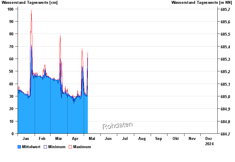
Jahresgrafik Fritz am Sand / Weiße Traun
Wasserstand vom 01.01.2024 bis zum 31.12.2024
- Hochwassergefahrenfläche HQ100 220 cm
| Datum | Mittelwert [cm] | Maximum [cm] | Minimum [cm] |
|---|---|---|---|
| 04.06.2024 | 88 | 100 | 78 |
| 03.06.2024 | 60 | 102 | 53 |
| 02.06.2024 | 63 | 72 | 55 |
| 01.06.2024 | 69 | 94 | 40 |
| 31.05.2024 | 43 | 56 | 30 |
| 30.05.2024 | 30 | 31 | 30 |
| 29.05.2024 | 31 | 31 | 30 |
© Bayerisches Landesamt für Umwelt 2024