
- Startseite >
- Flüsse >
- Wasserstand >
- Bayern >
- Bayreuth >
- Jahresgrafik

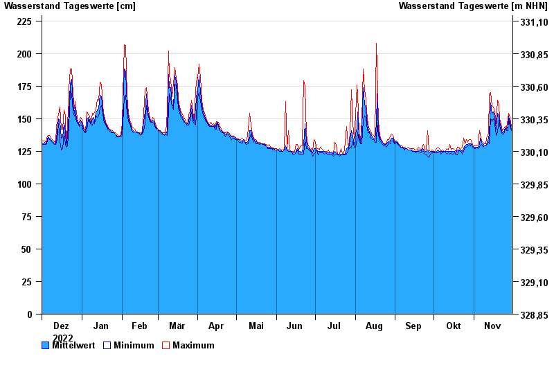
Jahresgrafik Bayreuth / Roter Main
Wasserstand vom 01.12.2022 bis zum 30.11.2023
- 26.01.1995 Wasserstand: 295 cm
- 06.06.1984 Wasserstand: 288 cm
- 15.06.1987 Wasserstand: 276 cm
- 21.12.1993 Wasserstand: 274 cm
- 13.01.2011 Wasserstand: 273 cm
| Datum | Mittelwert [cm] | Maximum [cm] | Minimum [cm] |
|---|---|---|---|
| 30.11.2023 | 142 | 144 | 141 |
| 29.11.2023 | 147 | 151 | 144 |
| 28.11.2023 | 152 | 154 | 150 |
| 27.11.2023 | 144 | 150 | 141 |
| 26.11.2023 | 142 | 143 | 141 |
| 25.11.2023 | 143 | 144 | 142 |
| 24.11.2023 | 140 | 142 | 138 |
© Bayerisches Landesamt für Umwelt 2024