
- Startseite >
- Flüsse >
- Wasserstand >
- Bayern >
- Alzenau >
- Jahresgrafik

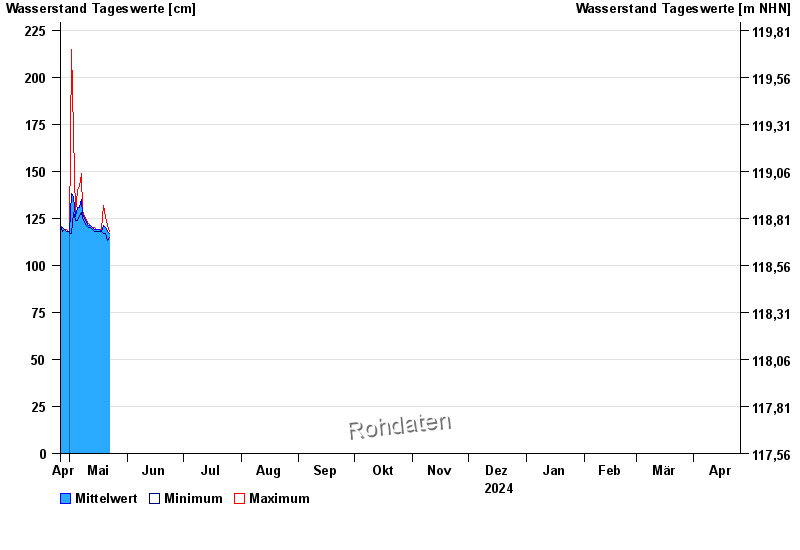
Jahresgrafik Alzenau / Kahl
Wasserstand vom 26.04.2024 bis zum 25.04.2025
- 04.05.2017 Wasserstand: 298 cm
- 13.02.2002 Wasserstand: 295 cm
- 03.01.2003 Wasserstand: 280 cm
- 26.01.1995 Wasserstand: 277 cm
- 29.10.1998 Wasserstand: 275 cm
| Datum | Mittelwert [cm] | Maximum [cm] | Minimum [cm] |
|---|---|---|---|
| 04.05.2024 | 126 | 128 | 125 |
| 03.05.2024 | 136 | 170 | 128 |
| 02.05.2024 | 138 | 215 | 117 |
| 01.05.2024 | 118 | 118 | 117 |
| 30.04.2024 | 118 | 118 | 118 |
| 29.04.2024 | 118 | 119 | 118 |
| 28.04.2024 | 119 | 119 | 119 |
© Bayerisches Landesamt für Umwelt 2024