
- Start >
- Rivers >
- Waterlevel >
- Regnitz >
- Schnaittach Markt >
- Chart of year

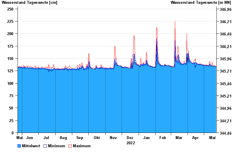
Chart of year Schnaittach Markt / Schnaittach
Waterlevel from 24.05.2022 to 23.05.2023
- Hochwassergefahrenfläche HQhäufig 260 cm
- Hochwassergefahrenfläche HQ100 290 cm
| Date | Mean value [cm] | Maximum [cm] | Minimum [cm] |
|---|---|---|---|
| 23.05.2023 | 134 | 135 | 133 |
| 22.05.2023 | 134 | 135 | 133 |
| 21.05.2023 | 134 | 135 | 134 |
| 20.05.2023 | 134 | 135 | 134 |
| 19.05.2023 | 134 | 135 | 134 |
| 18.05.2023 | 134 | 135 | 134 |
| 17.05.2023 | 135 | 135 | 134 |
© Bayerisches Landesamt für Umwelt 2024