
- Start >
- Rivers >
- Waterlevel >
- Regnitz >
- Rappoldshofen >
- Chart of year

Chart of year Rappoldshofen / Aisch
Waterlevel from 01.01.2024 to 18.04.2024
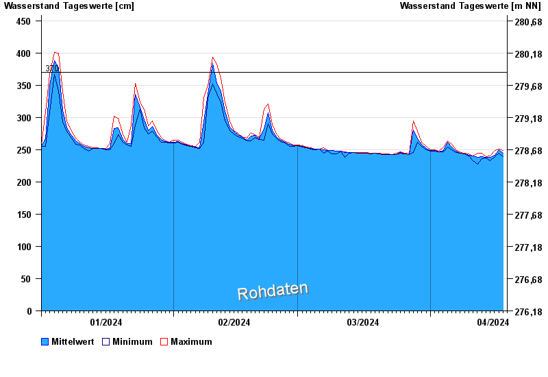
- 370 cm: Rappoldshofen: Beginn der Ausuferung.
| Date | Mean value [cm] | Maximum [cm] | Minimum [cm] |
|---|---|---|---|
| 18.04.2024 | 245 | 249 | 239 |
| 17.04.2024 | 250 | 251 | 245 |
| 16.04.2024 | 241 | 249 | 239 |
| 15.04.2024 | 238 | 240 | 233 |
| 14.04.2024 | 238 | 239 | 237 |
| 13.04.2024 | 239 | 244 | 236 |
| 12.04.2024 | 238 | 244 | 228 |
© Bayerisches Landesamt für Umwelt 2024