
- Start >
- Rivers >
- Waterlevel >
- Regnitz >
- Muggendorf >
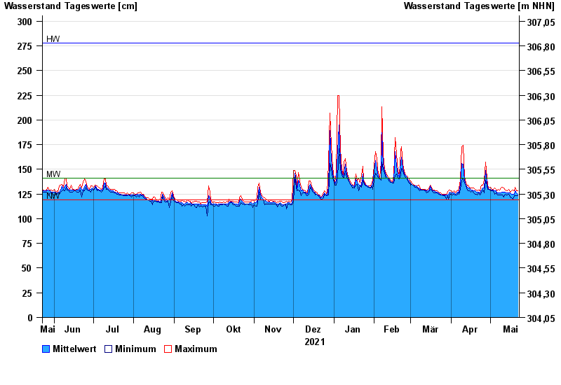
- Chart of year

Chart of year Muggendorf / Wiesent
Waterlevel from 23.05.2021 to 22.05.2022
| Date | Mean value [cm] | Maximum [cm] | Minimum [cm] |
|---|---|---|---|
| 22.05.2022 | 125 | 128 | 123 |
| 21.05.2022 | 126 | 128 | 123 |
| 20.05.2022 | 128 | 132 | 123 |
| 19.05.2022 | 125 | 128 | 123 |
| 18.05.2022 | 125 | 129 | 120 |
| 17.05.2022 | 125 | 128 | 121 |
| 16.05.2022 | 126 | 127 | 122 |
© Bayerisches Landesamt für Umwelt 2024