
- Start >
- Rivers >
- Waterlevel >
- Regnitz >
- Lauf >
- Chart of year

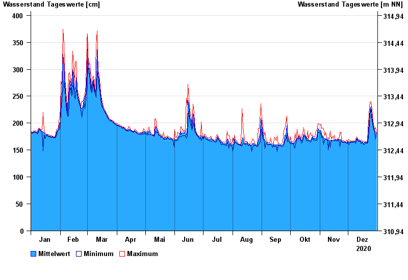
Chart of year Lauf / Pegnitz
Waterlevel from 01.01.2020 to 31.12.2020
- 26.01.1995 Wasserstand: 604 cm
- 21.12.1993 Wasserstand: 585 cm
- 25.03.1988 Wasserstand: 570 cm
- 13.01.2011 Wasserstand: 563 cm
- 02.03.1987 Wasserstand: 561 cm
| Date | Mean value [cm] | Maximum [cm] | Minimum [cm] |
|---|---|---|---|
| 31.12.2020 | 181 | 182 | 181 |
| 30.12.2020 | 183 | 192 | 170 |
| 29.12.2020 | 186 | 188 | 183 |
| 28.12.2020 | 190 | 193 | 185 |
| 27.12.2020 | 197 | 204 | 193 |
| 26.12.2020 | 212 | 226 | 204 |
| 25.12.2020 | 231 | 239 | 226 |
© Bayerisches Landesamt für Umwelt 2024