
- Start >
- Rivers >
- Waterlevel >
- Regnitz >
- Hohenstadt >
- Chart of year

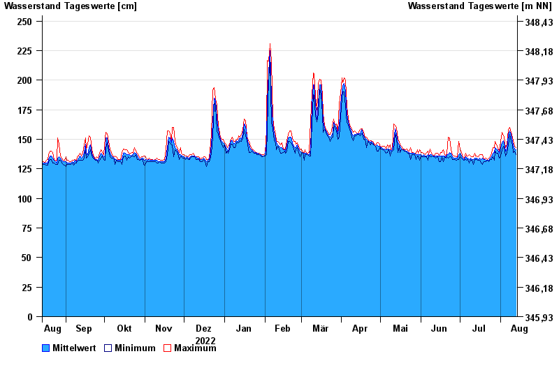
Chart of year Hohenstadt / Pegnitz
Waterlevel from 14.08.2022 to 13.08.2023
- 23.02.1970 Wasserstand: 311 cm
- 14.01.2011 Wasserstand: 307 cm
- 07.06.1984 Wasserstand: 305 cm
- 27.01.2002 Wasserstand: 303 cm
- 04.06.1971 Wasserstand: 303 cm
| Date | Mean value [cm] | Maximum [cm] | Minimum [cm] |
|---|---|---|---|
| 13.08.2023 | 141 | 143 | 137 |
| 12.08.2023 | 142 | 144 | 140 |
| 11.08.2023 | 145 | 149 | 139 |
| 10.08.2023 | 148 | 151 | 145 |
| 09.08.2023 | 154 | 156 | 148 |
| 08.08.2023 | 157 | 160 | 154 |
| 07.08.2023 | 154 | 158 | 145 |
© Bayerisches Landesamt für Umwelt 2024