
- Start >
- Rivers >
- Waterlevel >
- Regnitz >
- Hohenstadt >
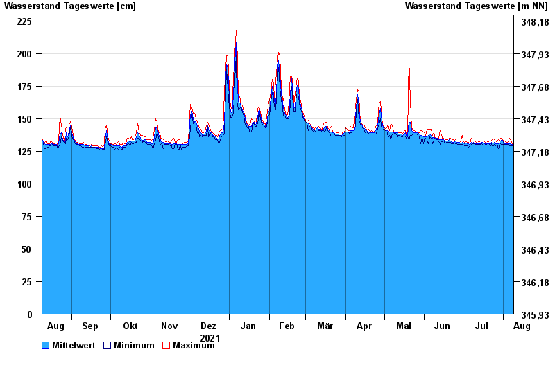
- Chart of year

Chart of year Hohenstadt / Pegnitz
Waterlevel from 09.08.2021 to 08.08.2022
- 23.02.1970 Wasserstand: 311 cm
- 14.01.2011 Wasserstand: 307 cm
- 07.06.1984 Wasserstand: 305 cm
- 27.01.2002 Wasserstand: 303 cm
- 04.06.1971 Wasserstand: 303 cm
| Date | Mean value [cm] | Maximum [cm] | Minimum [cm] |
|---|---|---|---|
| 08.08.2022 | 130 | 131 | 129 |
| 07.08.2022 | 131 | 133 | 129 |
| 06.08.2022 | 131 | 135 | 129 |
| 05.08.2022 | 131 | 133 | 130 |
| 04.08.2022 | 131 | 132 | 130 |
| 03.08.2022 | 131 | 132 | 130 |
| 02.08.2022 | 131 | 133 | 130 |
© Bayerisches Landesamt für Umwelt 2024