
- Start >
- Rivers >
- Waterlevel >
- Untere Donau >
- Straubing >
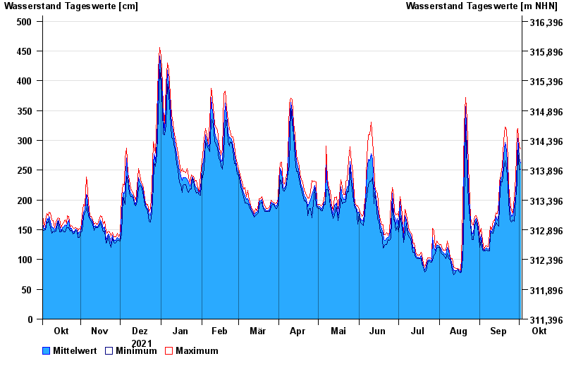
- Chart of year

Chart of year Straubing / Donau
Waterlevel from 03.10.2021 to 02.10.2022
| Date | Mean value [cm] | Maximum [cm] | Minimum [cm] |
|---|---|---|---|
| 02.10.2022 | 262 | 286 | 252 |
| 01.10.2022 | 271 | 289 | 251 |
| 30.09.2022 | 303 | 320 | 285 |
| 29.09.2022 | 263 | 316 | 230 |
| 28.09.2022 | 209 | 237 | 201 |
| 27.09.2022 | 190 | 204 | 164 |
| 26.09.2022 | 174 | 178 | 166 |
© Bayerisches Landesamt für Umwelt 2024