
- Start >
- Rivers >
- Waterlevel >
- Untere Donau >
- Straubing >
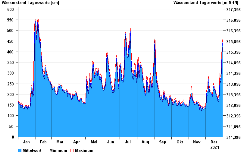
- Chart of year

Chart of year Straubing / Donau
Waterlevel from 01.01.2021 to 31.12.2021
- 05.06.2013 Wasserstand: 795 cm
- 14.08.2002 Wasserstand: 749 cm
- 28.03.1988 Wasserstand: 702 cm
- 16.01.2011 Wasserstand: 699 cm
- 25.05.1999 Wasserstand: 686 cm
| Date | Mean value [cm] | Maximum [cm] | Minimum [cm] |
|---|---|---|---|
| 31.12.2021 | 442 | 456 | 419 |
| 30.12.2021 | 390 | 419 | 342 |
| 29.12.2021 | 296 | 342 | 278 |
| 28.12.2021 | 265 | 279 | 256 |
| 27.12.2021 | 277 | 291 | 262 |
| 26.12.2021 | 259 | 298 | 222 |
| 25.12.2021 | 193 | 222 | 180 |
© Bayerisches Landesamt für Umwelt 2024