
- Start >
- Rivers >
- Waterlevel >
- Untere Donau >
- Schrottenbaummühle >
- Chart of year

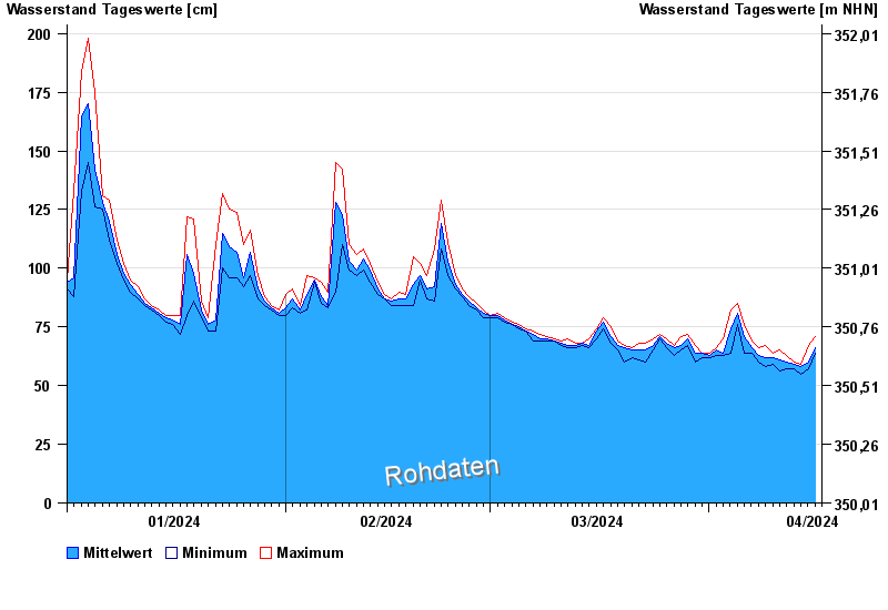
Chart of year Schrottenbaummühle / Ilz
Waterlevel from 01.01.2024 to 16.04.2024
- 21.12.1993 Wasserstand: 328 cm
- 16.03.2019 Wasserstand: 296 cm
- 13.08.2002 Wasserstand: 288 cm
- 12.03.1981 Wasserstand: 267 cm
- 01.03.2008 Wasserstand: 261 cm
| Date | Mean value [cm] | Maximum [cm] | Minimum [cm] |
|---|---|---|---|
| 16.04.2024 | 66 | 71 | 64 |
| 15.04.2024 | 60 | 67 | 57 |
| 14.04.2024 | 58 | 59 | 55 |
| 13.04.2024 | 59 | 60 | 57 |
| 12.04.2024 | 60 | 63 | 57 |
| 11.04.2024 | 61 | 65 | 56 |
| 10.04.2024 | 62 | 64 | 59 |
© Bayerisches Landesamt für Umwelt 2024