
- Start >
- Rivers >
- Waterlevel >
- Untere Donau >
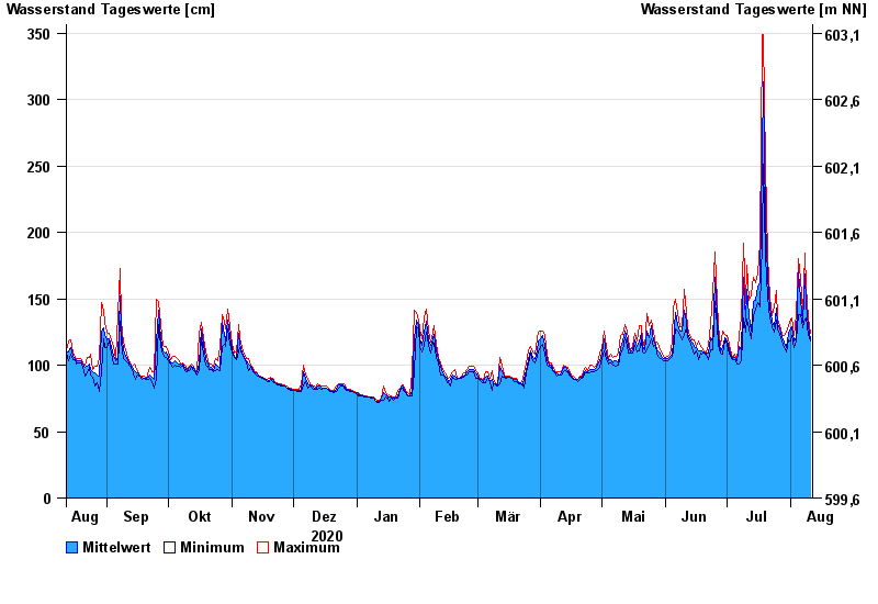
- Schlehdorf >
- Chart of year

Chart of year Schlehdorf / Loisach
Waterlevel from 12.08.2020 to 11.08.2021
| Date | Mean value [cm] | Maximum [cm] | Minimum [cm] |
|---|---|---|---|
| 11.08.2021 | 120 | 124 | 118 |
| 10.08.2021 | 129 | 136 | 123 |
| 09.08.2021 | 146 | 159 | 136 |
| 08.08.2021 | 169 | 184 | 135 |
| 07.08.2021 | 132 | 139 | 128 |
| 06.08.2021 | 150 | 165 | 138 |
| 05.08.2021 | 170 | 180 | 138 |
© Bayerisches Landesamt für Umwelt 2024