
- Start >
- Rivers >
- Waterlevel >
- Untere Donau >
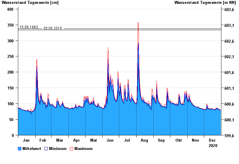
- Schlehdorf >
- Chart of year

Chart of year Schlehdorf / Loisach
Waterlevel from 01.01.2020 to 31.12.2020
- 22.05.1999 Wasserstand: 489 cm
- 23.08.2005 Wasserstand: 467 cm
- 03.06.2013 Wasserstand: 419 cm
- 15.06.1983 Wasserstand: 337 cm
- 03.06.2010 Wasserstand: 334 cm
| Date | Mean value [cm] | Maximum [cm] | Minimum [cm] |
|---|---|---|---|
| 31.12.2020 | 79 | 80 | 79 |
| 30.12.2020 | 80 | 81 | 80 |
| 29.12.2020 | 81 | 82 | 80 |
| 28.12.2020 | 82 | 82 | 81 |
| 27.12.2020 | 82 | 83 | 81 |
| 26.12.2020 | 84 | 86 | 83 |
| 25.12.2020 | 85 | 86 | 84 |
© Bayerisches Landesamt für Umwelt 2024