
- Start >
- Rivers >
- Waterlevel >
- Untere Donau >
- Ruhstorf >
- Chart of year

Chart of year Ruhstorf / Rott
Waterlevel from 01.01.2021 to 31.12.2021
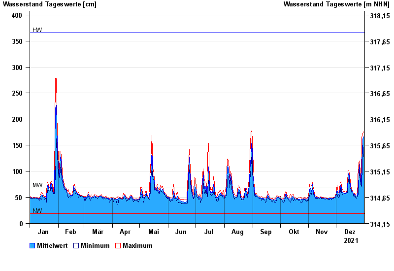
| Date | Mean value [cm] | Maximum [cm] | Minimum [cm] |
|---|---|---|---|
| 31.12.2021 | 166 | 176 | 128 |
| 30.12.2021 | 162 | 172 | 153 |
| 29.12.2021 | 117 | 164 | 73 |
| 28.12.2021 | 75 | 82 | 70 |
| 27.12.2021 | 90 | 103 | 82 |
| 26.12.2021 | 114 | 120 | 103 |
| 25.12.2021 | 74 | 109 | 57 |
© Bayerisches Landesamt für Umwelt 2024