
- Start >
- Rivers >
- Waterlevel >
- Untere Donau >
- Ruhstorf >
- Chart of month

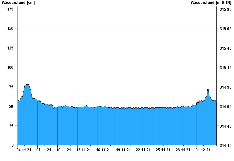
Chart of month Ruhstorf / Rott
Waterlevel from 04.11.2021 to 03.12.2021
- 02.06.2016 Wasserstand: 366 cm
- 23.02.1970 Wasserstand: 344 cm
- 03.08.1991 Wasserstand: 340 cm
- 03.06.2013 Wasserstand: 331 cm
- 02.02.1985 Wasserstand: 298 cm
| Date | Waterlevel [cm] |
|---|---|
| 03.12.2021 23:45 | 51 |
| 03.12.2021 23:30 | 51 |
| 03.12.2021 23:15 | 52 |
| 03.12.2021 23:00 | 53 |
| 03.12.2021 22:45 | 53 |
| 03.12.2021 22:30 | 53 |
| 03.12.2021 22:15 | 54 |
© Bayerisches Landesamt für Umwelt 2024