
- Start >
- Rivers >
- Waterlevel >
- Untere Donau >
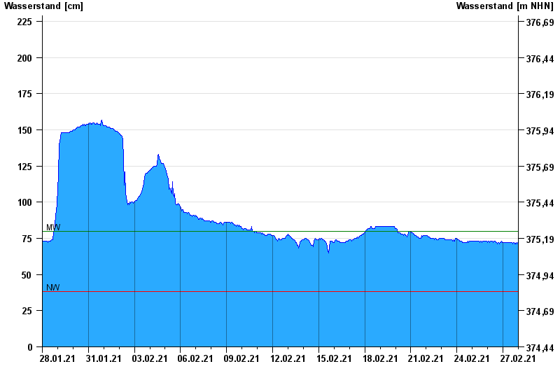
- Rottersdorf >
- Chart of month

Chart of month Rottersdorf / Vils
Waterlevel from 28.01.2021 to 27.02.2021
| Date | Waterlevel [cm] |
|---|---|
| 27.02.2021 23:45 | 72 |
| 27.02.2021 23:30 | 72 |
| 27.02.2021 23:15 | 72 |
| 27.02.2021 23:00 | 72 |
| 27.02.2021 22:45 | 72 |
| 27.02.2021 22:30 | 71 |
| 27.02.2021 22:15 | 71 |
© Bayerisches Landesamt für Umwelt 2024