
- Start >
- Rivers >
- Waterlevel >
- Untere Donau >
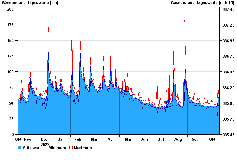
- Röhrnbach >
- Chart of year

Chart of year Röhrnbach / Osterbach
Waterlevel from 29.10.2022 to 28.10.2023
- 12.08.2002 Wasserstand: 264 cm
- 26.06.2016 Wasserstand: 261 cm
- 16.03.2019 Wasserstand: 250 cm
- 05.08.2010 Wasserstand: 239 cm
- 21.12.1993 Wasserstand: 236 cm
| Date | Mean value [cm] | Maximum [cm] | Minimum [cm] |
|---|---|---|---|
| 28.10.2023 | 56 | 62 | 48 |
| 27.10.2023 | 61 | 73 | 45 |
| 26.10.2023 | 46 | 64 | 30 |
| 25.10.2023 | 46 | 53 | 41 |
| 24.10.2023 | 45 | 48 | 42 |
| 23.10.2023 | 44 | 46 | 43 |
| 22.10.2023 | 45 | 48 | 42 |
© Bayerisches Landesamt für Umwelt 2024