
- Start >
- Rivers >
- Waterlevel >
- Untere Donau >
- Postmünster >
- Chart of year

Chart of year Postmünster / Gambach
Waterlevel from 01.01.2024 to 16.04.2024
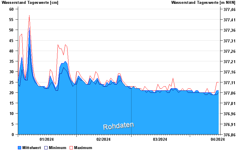
- Hochwassergefahrenfläche HQ100 150 cm
| Date | Mean value [cm] | Maximum [cm] | Minimum [cm] |
|---|---|---|---|
| 16.04.2024 | 22 | 25 | 20 |
| 15.04.2024 | 21 | 25 | 19 |
| 14.04.2024 | 19 | 20 | 19 |
| 13.04.2024 | 19 | 20 | 19 |
| 12.04.2024 | 20 | 20 | 19 |
| 11.04.2024 | 20 | 20 | 20 |
| 10.04.2024 | 20 | 22 | 19 |
© Bayerisches Landesamt für Umwelt 2024