
- Start >
- Rivers >
- Waterlevel >
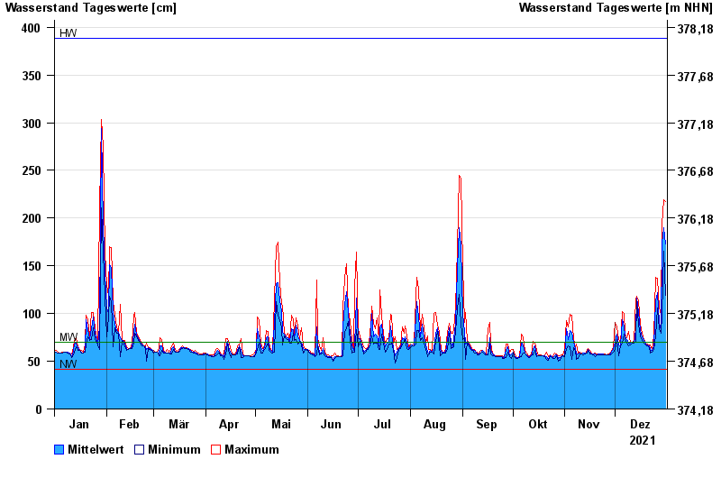
- Untere Donau >
- Postmünster >
- Chart of year

Chart of year Postmünster / Rott
Waterlevel from 01.01.2021 to 31.12.2021
| Date | Mean value [cm] | Maximum [cm] | Minimum [cm] |
|---|---|---|---|
| 31.12.2021 | 173 | 217 | 119 |
| 30.12.2021 | 190 | 219 | 165 |
| 29.12.2021 | 174 | 193 | 98 |
| 28.12.2021 | 82 | 98 | 79 |
| 27.12.2021 | 91 | 106 | 84 |
| 26.12.2021 | 122 | 137 | 106 |
| 25.12.2021 | 113 | 138 | 77 |
© Bayerisches Landesamt für Umwelt 2024