
- Start >
- Rivers >
- Waterlevel >
- Untere Donau >
- Plattling >
- Chart of year

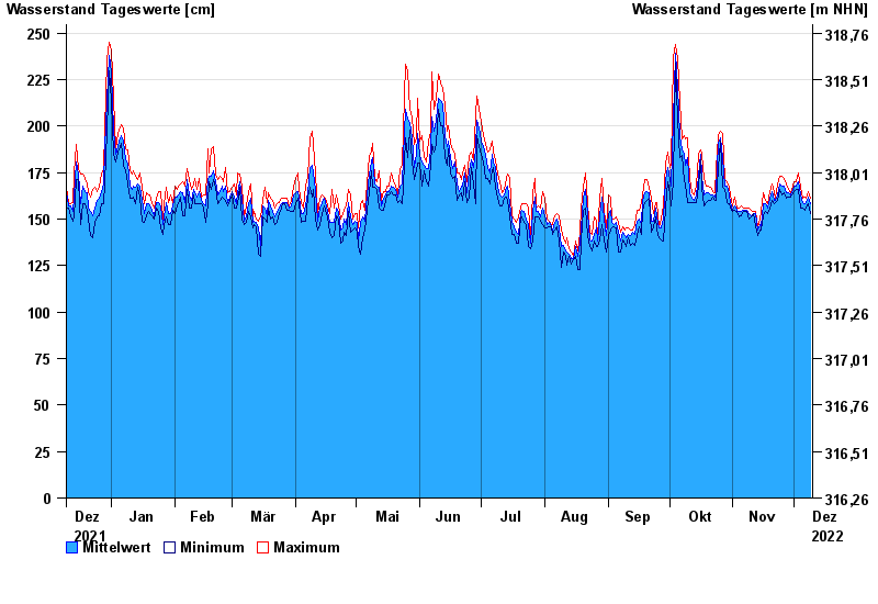
Chart of year Plattling / Isar
Waterlevel from 10.12.2021 to 09.12.2022
- 04.06.2013 Wasserstand: 400 cm
- 24.05.1999 Wasserstand: 378 cm
- 25.08.2005 Wasserstand: 374 cm
- 04.06.2010 Wasserstand: 349 cm
- 14.08.2002 Wasserstand: 335 cm
| Date | Mean value [cm] | Maximum [cm] | Minimum [cm] |
|---|---|---|---|
| 09.12.2022 | 158 | 161 | 153 |
| 08.12.2022 | 162 | 165 | 158 |
| 07.12.2022 | 159 | 161 | 156 |
| 06.12.2022 | 158 | 162 | 155 |
| 05.12.2022 | 159 | 161 | 156 |
| 04.12.2022 | 163 | 167 | 156 |
| 03.12.2022 | 170 | 175 | 166 |
© Bayerisches Landesamt für Umwelt 2024