
- Start >
- Rivers >
- Waterlevel >
- Untere Donau >
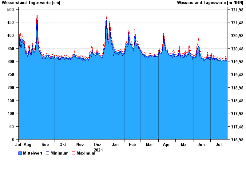
- Pfatter >
- Chart of year

Chart of year Pfatter / Donau
Waterlevel from 31.07.2021 to 30.07.2022
- 04.06.2013 Wasserstand: 780 cm
- 27.03.1988 Wasserstand: 772 cm
- 14.08.2002 Wasserstand: 746 cm
- 22.12.1993 Wasserstand: 732 cm
- 25.02.1970 Wasserstand: 728 cm
| Date | Mean value [cm] | Maximum [cm] | Minimum [cm] |
|---|---|---|---|
| 30.07.2022 | 311 | 317 | 307 |
| 29.07.2022 | 305 | 309 | 303 |
| 28.07.2022 | 306 | 312 | 301 |
| 27.07.2022 | 313 | 320 | 302 |
| 26.07.2022 | 302 | 307 | 300 |
| 25.07.2022 | 304 | 310 | 301 |
| 24.07.2022 | 304 | 309 | 301 |
© Bayerisches Landesamt für Umwelt 2024