
- Start >
- Rivers >
- Waterlevel >
- Untere Donau >
- Pfatter >
- Chart of year

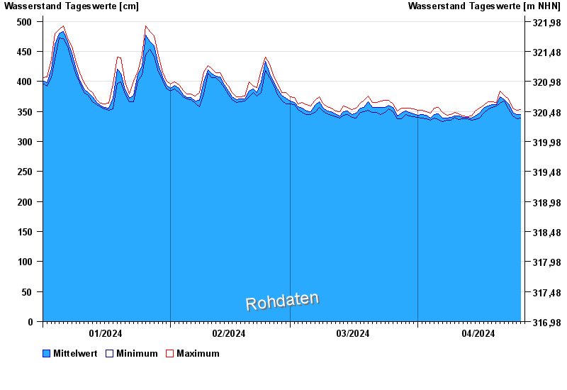
Chart of year Pfatter / Donau
Waterlevel from 01.01.2024 to 26.04.2024
 Für diesen Pegel sind keine Hochwassermarken hinterlegt.
| Date | Mean value [cm] | Maximum [cm] | Minimum [cm] |
|---|---|---|---|
| 26.04.2024 | 339 | 339 | 339 |
| 25.04.2024 | 345 | 352 | 338 |
| 24.04.2024 | 349 | 355 | 342 |
| 23.04.2024 | 363 | 371 | 354 |
| 22.04.2024 | 370 | 377 | 367 |
| 21.04.2024 | 375 | 384 | 364 |
| 20.04.2024 | 362 | 365 | 359 |
© Bayerisches Landesamt für Umwelt 2024