
- Start >
- Rivers >
- Waterlevel >
- Untere Donau >
- Passau Ingling >
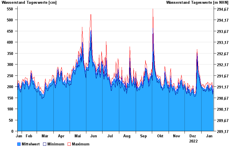
- Chart of year

Chart of year Passau Ingling / Inn
Waterlevel from 24.01.2022 to 23.01.2023
- Hochwassergefahrenfläche HQ100 1140 cm
| Date | Mean value [cm] | Maximum [cm] | Minimum [cm] |
|---|---|---|---|
| 23.01.2023 | 191 | 205 | 179 |
| 22.01.2023 | 176 | 193 | 165 |
| 21.01.2023 | 202 | 218 | 188 |
| 20.01.2023 | 208 | 218 | 191 |
| 19.01.2023 | 197 | 208 | 190 |
| 18.01.2023 | 195 | 206 | 182 |
| 17.01.2023 | 195 | 213 | 183 |
© Bayerisches Landesamt für Umwelt 2024