
- Start >
- Rivers >
- Waterlevel >
- Untere Donau >
- Passau Ingling >
- Chart of year

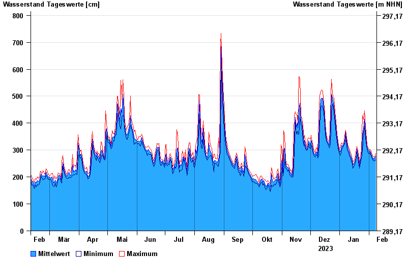
Chart of year Passau Ingling / Inn
Waterlevel from 09.02.2023 to 08.02.2024
- Hochwassergefahrenfläche HQ100 1140 cm
| Date | Mean value [cm] | Maximum [cm] | Minimum [cm] |
|---|---|---|---|
| 08.02.2024 | 277 | 287 | 264 |
| 07.02.2024 | 266 | 273 | 258 |
| 06.02.2024 | 270 | 275 | 263 |
| 05.02.2024 | 267 | 275 | 260 |
| 04.02.2024 | 275 | 281 | 269 |
| 03.02.2024 | 286 | 296 | 275 |
| 02.02.2024 | 296 | 302 | 291 |
© Bayerisches Landesamt für Umwelt 2024