
- Start >
- Rivers >
- Waterlevel >
- Untere Donau >
- Passau >
- Chart of year

Chart of year Passau / Donau
Waterlevel from 01.01.2022 to 31.12.2022
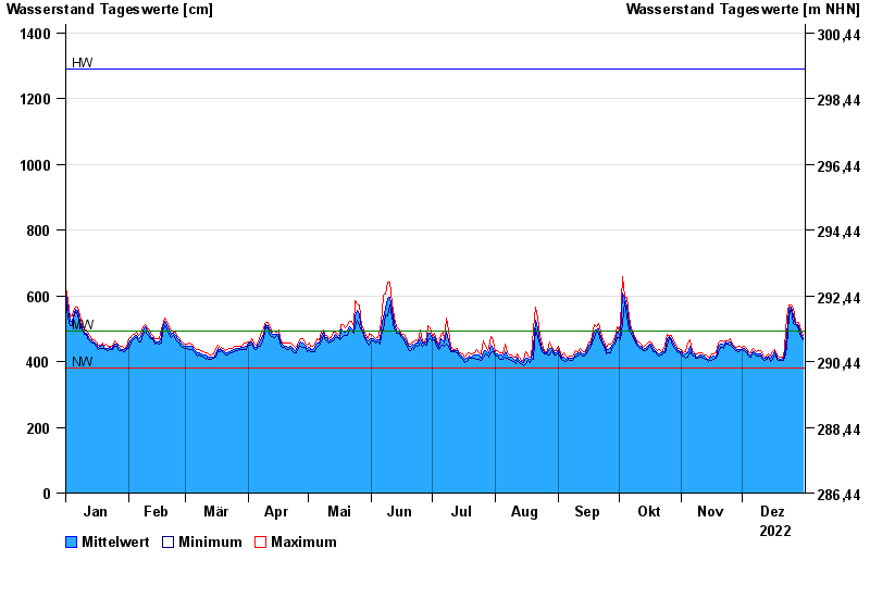
| Date | Mean value [cm] | Maximum [cm] | Minimum [cm] |
|---|---|---|---|
| 31.12.2022 | 471 | 478 | 467 |
| 30.12.2022 | 485 | 496 | 476 |
| 29.12.2022 | 506 | 520 | 494 |
| 28.12.2022 | 513 | 518 | 509 |
| 27.12.2022 | 517 | 523 | 512 |
| 26.12.2022 | 539 | 563 | 515 |
| 25.12.2022 | 565 | 572 | 561 |
© Bayerisches Landesamt für Umwelt 2024