
- Start >
- Rivers >
- Waterlevel >
- Untere Donau >
- Passau >
- Chart of year

Chart of year Passau / Donau
Waterlevel from 01.01.2021 to 31.12.2021
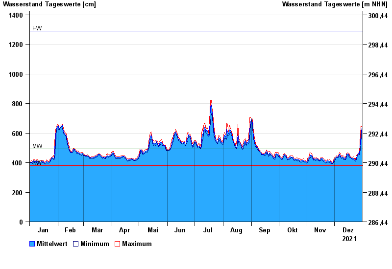
| Date | Mean value [cm] | Maximum [cm] | Minimum [cm] |
|---|---|---|---|
| 31.12.2021 | 635 | 644 | 625 |
| 30.12.2021 | 586 | 648 | 534 |
| 29.12.2021 | 499 | 534 | 463 |
| 28.12.2021 | 458 | 463 | 453 |
| 27.12.2021 | 463 | 467 | 453 |
| 26.12.2021 | 451 | 454 | 446 |
| 25.12.2021 | 434 | 450 | 419 |
© Bayerisches Landesamt für Umwelt 2024