
- Start >
- Rivers >
- Waterlevel >
- Untere Donau >
- Neustift >
- Chart of year

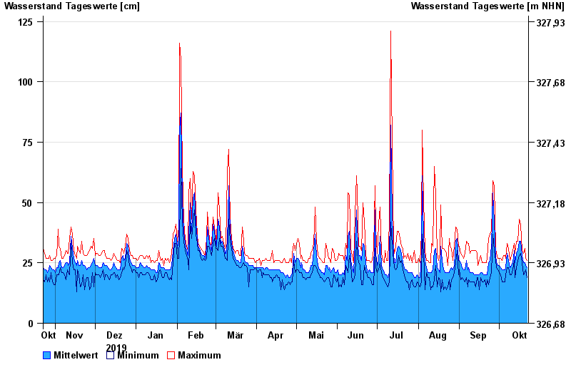
Chart of year Neustift / Wolfach
Waterlevel from 23.10.2019 to 22.10.2020
- Hochwassergefahrenfläche HQ100 380 cm
| Date | Mean value [cm] | Maximum [cm] | Minimum [cm] |
|---|---|---|---|
| 22.10.2020 | 23 | 26 | 19 |
| 21.10.2020 | 24 | 27 | 22 |
| 20.10.2020 | 25 | 31 | 21 |
| 19.10.2020 | 25 | 29 | 20 |
| 18.10.2020 | 28 | 30 | 25 |
| 17.10.2020 | 34 | 41 | 29 |
| 16.10.2020 | 34 | 43 | 28 |
© Bayerisches Landesamt für Umwelt 2024