
- Start >
- Rivers >
- Waterlevel >
- Untere Donau >
- Landau >
- Chart of year

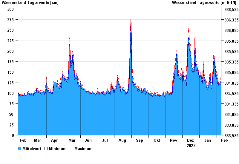
Chart of year Landau / Isar
Waterlevel from 09.02.2023 to 08.02.2024
| Date | Mean value [cm] | Maximum [cm] | Minimum [cm] |
|---|---|---|---|
| 08.02.2024 | 128 | 137 | 121 |
| 07.02.2024 | 123 | 128 | 120 |
| 06.02.2024 | 125 | 128 | 121 |
| 05.02.2024 | 122 | 127 | 120 |
| 04.02.2024 | 120 | 122 | 117 |
| 03.02.2024 | 132 | 139 | 120 |
| 02.02.2024 | 136 | 146 | 126 |
© Bayerisches Landesamt für Umwelt 2024