
- Start >
- Rivers >
- Waterlevel >
- Untere Donau >
- Landau >
- Chart of year

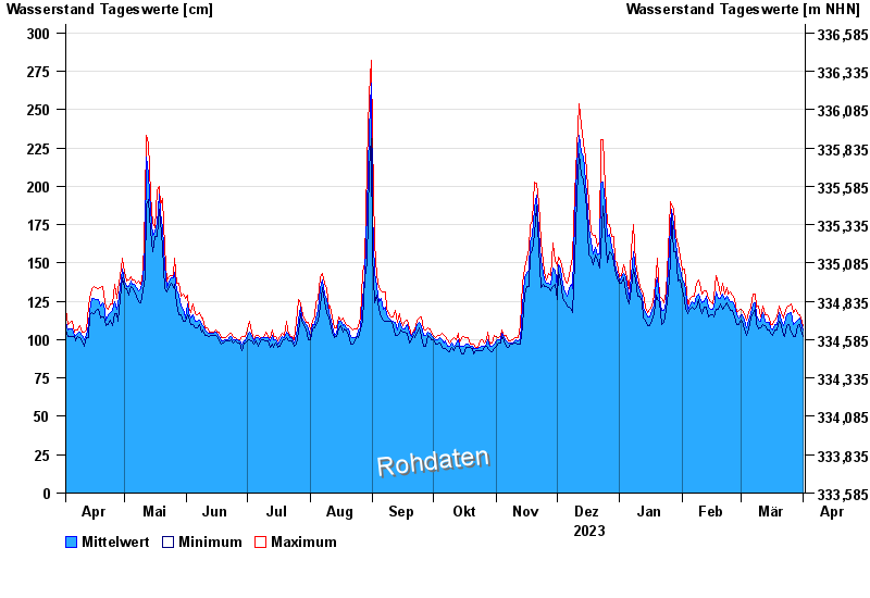
Chart of year Landau / Isar
Waterlevel from 02.04.2023 to 01.04.2024
- 380 cm: Landau: Überflutung der Vorländer.
- 460 cm: Landau: Aufruf der Deichwehren.
- 600 cm: Landau: Überflutung der Deiche an den Tiefstellen.
| Date | Mean value [cm] | Maximum [cm] | Minimum [cm] |
|---|---|---|---|
| 01.04.2024 | 106 | 109 | 102 |
| 31.03.2024 | 111 | 114 | 106 |
| 30.03.2024 | 114 | 116 | 110 |
| 29.03.2024 | 113 | 117 | 109 |
| 28.03.2024 | 111 | 120 | 102 |
| 27.03.2024 | 110 | 118 | 102 |
| 26.03.2024 | 118 | 123 | 105 |
© Bayerisches Landesamt für Umwelt 2024