
- Start >
- Rivers >
- Waterlevel >
- Untere Donau >
- Kempten >
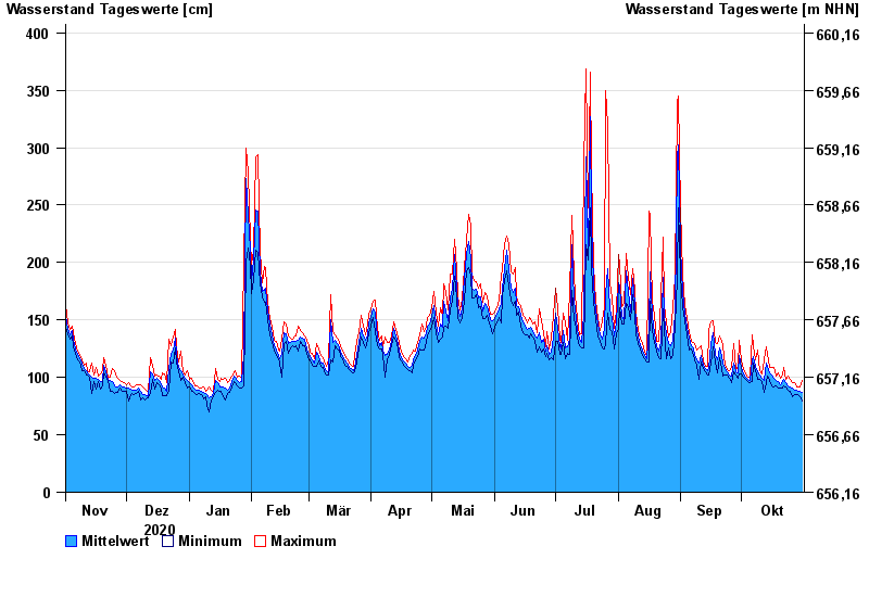
- Chart of year

Chart of year Kempten / Iller
Waterlevel from 01.11.2020 to 31.10.2021
- 23.08.2005 Wasserstand: 646 cm
- 22.05.1999 Wasserstand: 631 cm
- 12.08.2002 Wasserstand: 555 cm
- 10.08.1970 Wasserstand: 542 cm
- 02.06.2013 Wasserstand: 535 cm
| Date | Mean value [cm] | Maximum [cm] | Minimum [cm] |
|---|---|---|---|
| 31.10.2021 | 87 | 97 | 79 |
| 30.10.2021 | 88 | 92 | 83 |
| 29.10.2021 | 88 | 92 | 85 |
| 28.10.2021 | 89 | 92 | 85 |
| 27.10.2021 | 89 | 95 | 85 |
| 26.10.2021 | 91 | 95 | 83 |
| 25.10.2021 | 92 | 98 | 88 |
© Bayerisches Landesamt für Umwelt 2024