
- Start >
- Rivers >
- Waterlevel >
- Untere Donau >
- Grafenau >
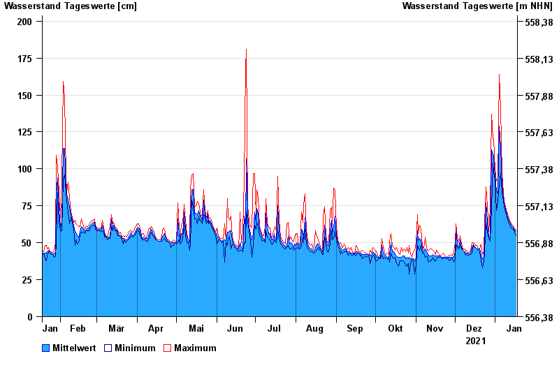
- Chart of year

Chart of year Grafenau / Kleine Ohe
Waterlevel from 18.01.2021 to 17.01.2022
- 12.08.2002 Wasserstand: 272 cm
- 21.12.1993 Wasserstand: 247 cm
- 21.03.2002 Wasserstand: 233 cm
- 09.08.2002 Wasserstand: 214 cm
- 19.12.1987 Wasserstand: 212 cm
| Date | Mean value [cm] | Maximum [cm] | Minimum [cm] |
|---|---|---|---|
| 17.01.2022 | 58 | 59 | 55 |
| 16.01.2022 | 58 | 59 | 57 |
| 15.01.2022 | 60 | 61 | 59 |
| 14.01.2022 | 61 | 62 | 59 |
| 13.01.2022 | 62 | 63 | 60 |
| 12.01.2022 | 64 | 65 | 62 |
| 11.01.2022 | 66 | 68 | 64 |
© Bayerisches Landesamt für Umwelt 2024