
- Start >
- Rivers >
- Waterlevel >
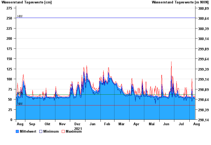
- Untere Donau >
- Erlachleiten >
- Chart of year

Chart of year Erlachleiten / Erlau
Waterlevel from 13.08.2021 to 12.08.2022
| Date | Mean value [cm] | Maximum [cm] | Minimum [cm] |
|---|---|---|---|
| 12.08.2022 | 54 | 55 | 53 |
| 11.08.2022 | 55 | 59 | 51 |
| 10.08.2022 | 54 | 55 | 53 |
| 09.08.2022 | 55 | 57 | 53 |
| 08.08.2022 | 55 | 58 | 54 |
| 07.08.2022 | 57 | 72 | 49 |
| 06.08.2022 | 75 | 101 | 45 |
© Bayerisches Landesamt für Umwelt 2024