
- Start >
- Rivers >
- Waterlevel >
- Untere Donau >
- Chamerau >
- Chart of year

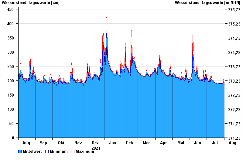
Chart of year Chamerau / Regen
Waterlevel from 02.08.2021 to 01.08.2022
- 13.08.2002 Wasserstand: 680 cm
- 21.12.1993 Wasserstand: 600 cm
- 22.07.1980 Wasserstand: 575 cm
- 01.11.1998 Wasserstand: 555 cm
- 21.03.2002 Wasserstand: 543 cm
| Date | Mean value [cm] | Maximum [cm] | Minimum [cm] |
|---|---|---|---|
| 01.08.2022 | 192 | 193 | 186 |
| 31.07.2022 | 196 | 198 | 193 |
| 30.07.2022 | 201 | 209 | 191 |
| 29.07.2022 | 189 | 191 | 188 |
| 28.07.2022 | 188 | 189 | 188 |
| 27.07.2022 | 190 | 191 | 189 |
| 26.07.2022 | 190 | 190 | 189 |
© Bayerisches Landesamt für Umwelt 2024