
- Start >
- Rivers >
- Waterlevel >
- Untere Donau >
- Chamerau >
- Chart of year

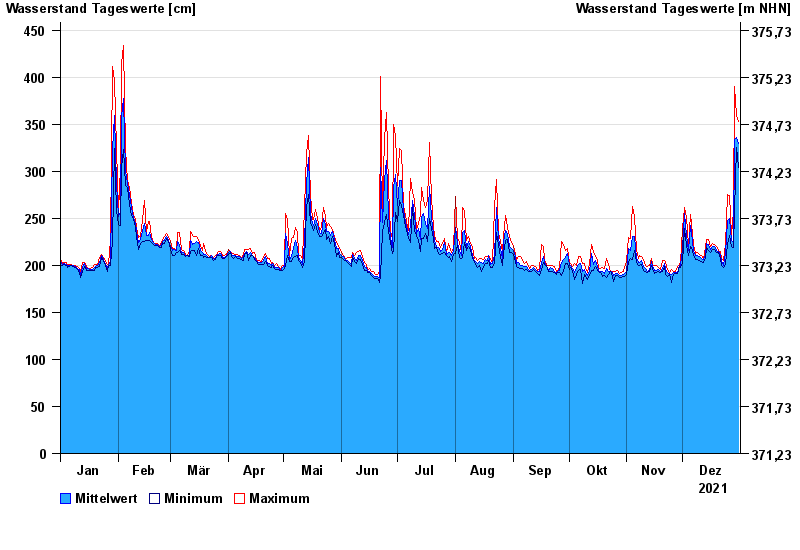
Chart of year Chamerau / Regen
Waterlevel from 01.01.2021 to 31.12.2021
- 13.08.2002 Wasserstand: 680 cm
- 21.12.1993 Wasserstand: 600 cm
- 22.07.1980 Wasserstand: 575 cm
- 01.11.1998 Wasserstand: 555 cm
- 21.03.2002 Wasserstand: 543 cm
| Date | Mean value [cm] | Maximum [cm] | Minimum [cm] |
|---|---|---|---|
| 31.12.2021 | 330 | 353 | 304 |
| 30.12.2021 | 336 | 359 | 325 |
| 29.12.2021 | 334 | 390 | 258 |
| 28.12.2021 | 225 | 258 | 219 |
| 27.12.2021 | 226 | 232 | 220 |
| 26.12.2021 | 250 | 274 | 232 |
| 25.12.2021 | 248 | 275 | 222 |
© Bayerisches Landesamt für Umwelt 2024