
- Start >
- Rivers >
- Waterlevel >
- Untere Donau >
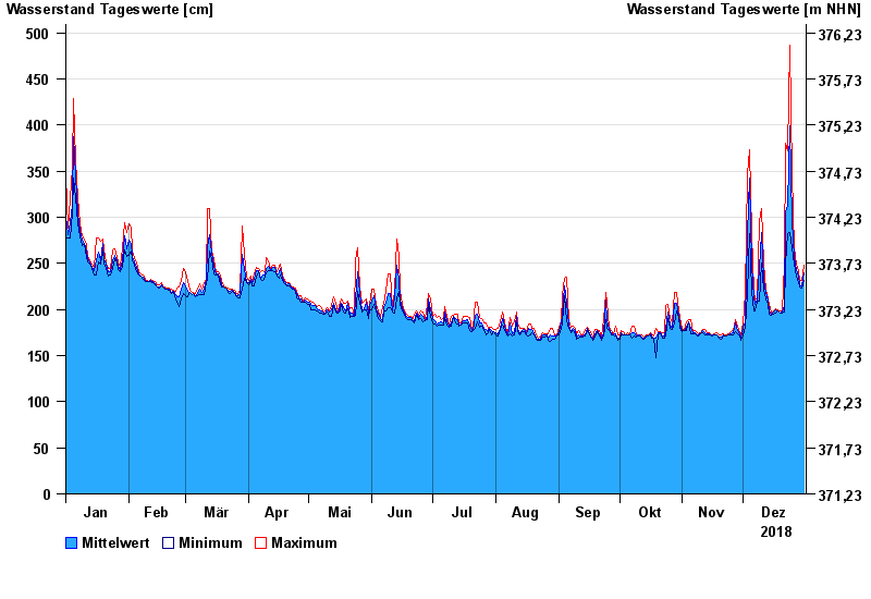
- Chamerau >
- Chart of year

Chart of year Chamerau / Regen
Waterlevel from 01.01.2018 to 31.12.2018
- 13.08.2002 Wasserstand: 680 cm
- 21.12.1993 Wasserstand: 600 cm
- 22.07.1980 Wasserstand: 575 cm
- 01.11.1998 Wasserstand: 555 cm
- 21.03.2002 Wasserstand: 543 cm
| Date | Mean value [cm] | Maximum [cm] | Minimum [cm] |
|---|---|---|---|
| 31.12.2018 | 240 | 248 | 231 |
| 30.12.2018 | 226 | 231 | 223 |
| 29.12.2018 | 227 | 231 | 224 |
| 28.12.2018 | 236 | 242 | 229 |
| 27.12.2018 | 243 | 249 | 236 |
| 26.12.2018 | 256 | 267 | 249 |
| 25.12.2018 | 296 | 346 | 267 |
© Bayerisches Landesamt für Umwelt 2024