
- Start >
- Rivers >
- Waterlevel >
- Untere Donau >
- Arzberg >
- Chart of year

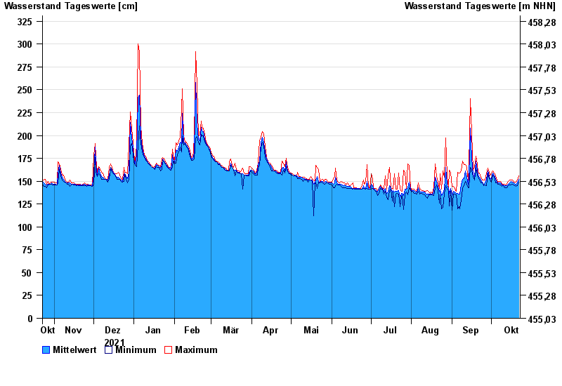
Chart of year Arzberg / Röslau
Waterlevel from 23.10.2021 to 22.10.2022
- 28.05.2006 Wasserstand: 396 cm
- 01.11.1998 Wasserstand: 396 cm
- 01.09.1977 Wasserstand: 385 cm
- 26.01.1995 Wasserstand: 384 cm
- 12.02.2005 Wasserstand: 374 cm
| Date | Mean value [cm] | Maximum [cm] | Minimum [cm] |
|---|---|---|---|
| 22.10.2022 | 152 | 156 | 149 |
| 21.10.2022 | 148 | 151 | 145 |
| 20.10.2022 | 147 | 149 | 144 |
| 19.10.2022 | 147 | 149 | 145 |
| 18.10.2022 | 148 | 149 | 146 |
| 17.10.2022 | 149 | 151 | 147 |
| 16.10.2022 | 150 | 151 | 146 |
© Bayerisches Landesamt für Umwelt 2024