
- Start >
- Rivers >
- Waterlevel >
- Untere Donau >
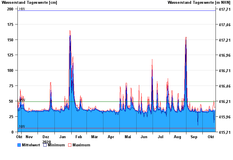
- Aham >
- Chart of year

Chart of year Aham / Vils
Waterlevel from 25.10.2020 to 24.10.2021
| Date | Mean value [cm] | Maximum [cm] | Minimum [cm] |
|---|---|---|---|
| 24.10.2021 | 36 | 40 | 33 |
| 23.10.2021 | 34 | 39 | 31 |
| 22.10.2021 | 33 | 51 | 15 |
| 21.10.2021 | 36 | 46 | 28 |
| 20.10.2021 | 36 | 42 | 34 |
| 19.10.2021 | 34 | 37 | 33 |
| 18.10.2021 | 34 | 34 | 33 |
© Bayerisches Landesamt für Umwelt 2024