
- Start >
- Rivers >
- Waterlevel >
- Untere Donau >
- Aham >
- Chart of month

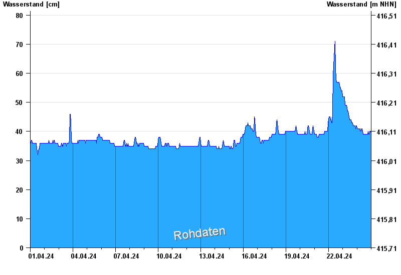
Chart of month Aham / Vils
Waterlevel from 01.04.2024 to 24.04.2024
- Hochwassergefahrenfläche HQ100 220 cm
| Date | Waterlevel [cm] |
|---|---|
| 24.04.2024 10:30 | 39 |
| 24.04.2024 10:15 | 39 |
| 24.04.2024 10:00 | 39 |
| 24.04.2024 09:45 | 39 |
| 24.04.2024 09:30 | 40 |
| 24.04.2024 09:15 | 40 |
| 24.04.2024 09:00 | 40 |
© Bayerisches Landesamt für Umwelt 2024