
- Start >
- Rivers >
- Waterlevel >
- Naab - Regen >
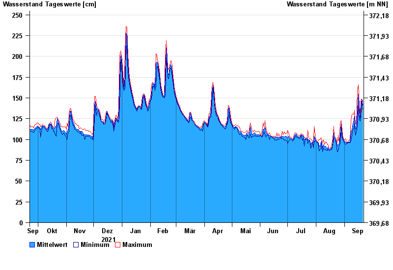
- Unterköblitz >
- Chart of year

Chart of year Unterköblitz / Naab
Waterlevel from 22.09.2021 to 21.09.2022
- 15.01.2011 Wasserstand: 391 cm
- 27.01.1995 Wasserstand: 373 cm
- 03.01.2003 Wasserstand: 368 cm
- 26.03.1988 Wasserstand: 350 cm
- 07.02.1980 Wasserstand: 350 cm
| Date | Mean value [cm] | Maximum [cm] | Minimum [cm] |
|---|---|---|---|
| 21.09.2022 | 141 | 146 | 136 |
| 20.09.2022 | 148 | 149 | 146 |
| 19.09.2022 | 140 | 147 | 128 |
| 18.09.2022 | 124 | 128 | 122 |
| 17.09.2022 | 131 | 140 | 124 |
| 16.09.2022 | 155 | 166 | 140 |
| 15.09.2022 | 136 | 158 | 117 |
© Bayerisches Landesamt für Umwelt 2024