
- Start >
- Rivers >
- Waterlevel >
- Naab - Regen >
- Unterköblitz >
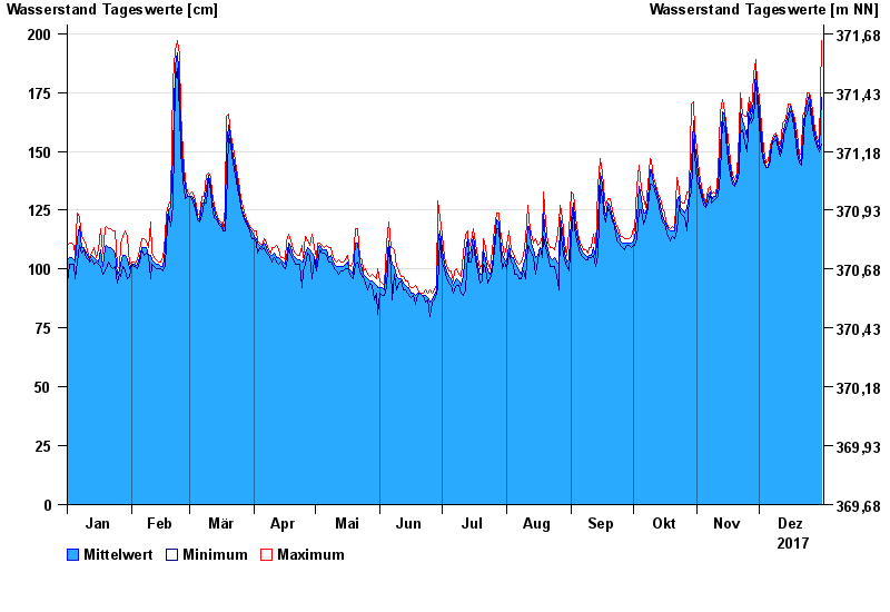
- Chart of year

Chart of year Unterköblitz / Naab
Waterlevel from 01.01.2017 to 31.12.2017
- 15.01.2011 Wasserstand: 391 cm
- 27.01.1995 Wasserstand: 373 cm
- 03.01.2003 Wasserstand: 368 cm
- 26.03.1988 Wasserstand: 350 cm
- 07.02.1980 Wasserstand: 350 cm
| Date | Mean value [cm] | Maximum [cm] | Minimum [cm] |
|---|---|---|---|
| 31.12.2017 | 173 | 197 | 153 |
| 30.12.2017 | 151 | 153 | 150 |
| 29.12.2017 | 153 | 156 | 152 |
| 28.12.2017 | 156 | 157 | 153 |
| 27.12.2017 | 159 | 163 | 157 |
| 26.12.2017 | 167 | 171 | 163 |
| 25.12.2017 | 174 | 175 | 171 |
© Bayerisches Landesamt für Umwelt 2024