
- Start >
- Rivers >
- Waterlevel >
- Naab - Regen >
- Unterköblitz >
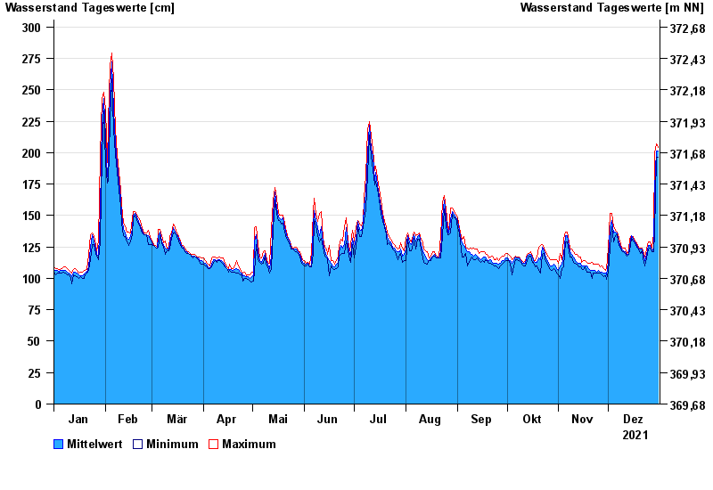
- Chart of year

Chart of year Unterköblitz / Naab
Waterlevel from 01.01.2021 to 31.12.2021
- 15.01.2011 Wasserstand: 391 cm
- 27.01.1995 Wasserstand: 373 cm
- 03.01.2003 Wasserstand: 368 cm
- 26.03.1988 Wasserstand: 350 cm
- 07.02.1980 Wasserstand: 350 cm
| Date | Mean value [cm] | Maximum [cm] | Minimum [cm] |
|---|---|---|---|
| 31.12.2021 | 201 | 204 | 196 |
| 30.12.2021 | 201 | 207 | 196 |
| 29.12.2021 | 171 | 200 | 136 |
| 28.12.2021 | 124 | 136 | 121 |
| 27.12.2021 | 122 | 124 | 121 |
| 26.12.2021 | 126 | 129 | 124 |
| 25.12.2021 | 126 | 129 | 123 |
© Bayerisches Landesamt für Umwelt 2024