
- Start >
- Rivers >
- Waterlevel >
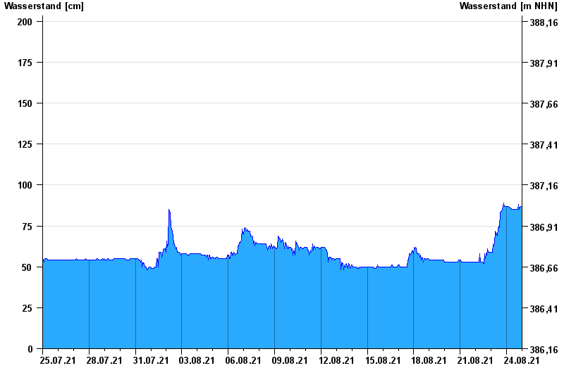
- Naab - Regen >
- Trausnitz u. d. Mühle >
- Chart of month

Chart of month Trausnitz u. d. Mühle / Pfreimd
Waterlevel from 25.07.2021 to 24.08.2021
- 530 cm: Trausnitz: Überflutung der Mühle Kraus ca. 10 cm.
| Date | Waterlevel [cm] |
|---|---|
| 25.08.2021 00:45 | 87 |
| 25.08.2021 00:30 | 87 |
| 25.08.2021 00:15 | 87 |
| 25.08.2021 00:00 | 87 |
| 24.08.2021 23:45 | 87 |
| 24.08.2021 23:30 | 87 |
| 24.08.2021 23:15 | 87 |
© Bayerisches Landesamt für Umwelt 2024