
- Start >
- Rivers >
- Waterlevel >
- Naab - Regen >
- Teisnach >
- Chart of year

Chart of year Teisnach / Teisnach
Waterlevel from 08.07.2020 to 07.07.2021
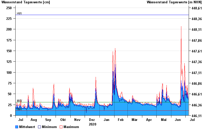
| Date | Mean value [cm] | Maximum [cm] | Minimum [cm] |
|---|---|---|---|
| 07.07.2021 | 40 | 42 | 38 |
| 06.07.2021 | 42 | 45 | 38 |
| 05.07.2021 | 54 | 70 | 44 |
| 04.07.2021 | 43 | 44 | 40 |
| 03.07.2021 | 49 | 57 | 44 |
| 02.07.2021 | 58 | 69 | 51 |
| 01.07.2021 | 54 | 61 | 48 |
© Bayerisches Landesamt für Umwelt 2024