
- Start >
- Rivers >
- Waterlevel >
- Naab - Regen >
- Teisnach >
- Current values

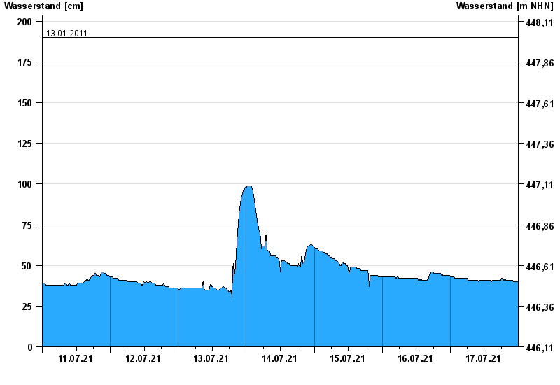
Current values Teisnach / Teisnach
Waterlevel from 11.07.2021 to 17.07.2021
- 03.12.2007 Wasserstand: 233 cm
- 01.03.2008 Wasserstand: 216 cm
- 12.02.2005 Wasserstand: 207 cm
- 12.09.2008 Wasserstand: 201 cm
- 13.01.2011 Wasserstand: 190 cm
| Date | Waterlevel [cm] |
|---|---|
| 18.07.2021 00:45 | 40 |
| 18.07.2021 00:30 | 40 |
| 18.07.2021 00:15 | 40 |
| 18.07.2021 00:00 | 40 |
| 17.07.2021 23:45 | 40 |
| 17.07.2021 23:30 | 40 |
| 17.07.2021 23:15 | 40 |
© Bayerisches Landesamt für Umwelt 2024