
- Start >
- Rivers >
- Waterlevel >
- Naab - Regen >
- Schwabelweis >
- Chart of year

Chart of year Schwabelweis / Donau
Waterlevel from 01.01.2024 to 16.04.2024
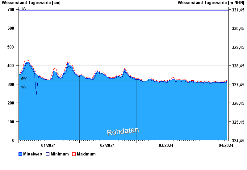
| Date | Mean value [cm] | Maximum [cm] | Minimum [cm] |
|---|---|---|---|
| 16.04.2024 | 312 | 315 | 310 |
| 15.04.2024 | 311 | 314 | 308 |
| 14.04.2024 | 310 | 313 | 308 |
| 13.04.2024 | 310 | 313 | 308 |
| 12.04.2024 | 311 | 311 | 309 |
| 11.04.2024 | 312 | 313 | 310 |
| 10.04.2024 | 312 | 314 | 310 |
© Bayerisches Landesamt für Umwelt 2024