
- Start >
- Rivers >
- Waterlevel >
- Naab - Regen >
- Pommelsbrunn >
- Chart of year

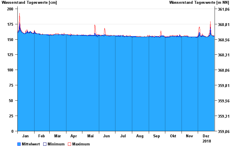
Chart of year Pommelsbrunn / Högenbach
Waterlevel from 01.01.2018 to 31.12.2018
- 13.01.2011 Wasserstand: 292 cm
- 21.12.1993 Wasserstand: 290 cm
- 26.01.1995 Wasserstand: 286 cm
- 23.02.1970 Wasserstand: 265 cm
- 31.01.1982 Wasserstand: 263 cm
| Date | Mean value [cm] | Maximum [cm] | Minimum [cm] |
|---|---|---|---|
| 31.12.2018 | 155 | 156 | 155 |
| 30.12.2018 | 156 | 157 | 155 |
| 29.12.2018 | 155 | 156 | 155 |
| 28.12.2018 | 156 | 156 | 156 |
| 27.12.2018 | 156 | 157 | 156 |
| 26.12.2018 | 157 | 158 | 157 |
| 25.12.2018 | 158 | 160 | 158 |
© Bayerisches Landesamt für Umwelt 2024