
- Start >
- Rivers >
- Waterlevel >
- Naab - Regen >
- Plattling >
- Chart of year

Chart of year Plattling / Isar
Waterlevel from 01.01.2017 to 31.12.2017
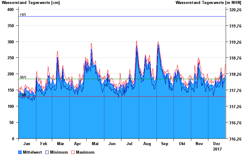
| Date | Mean value [cm] | Maximum [cm] | Minimum [cm] |
|---|---|---|---|
| 31.12.2017 | 196 | 230 | 182 |
| 30.12.2017 | 188 | 199 | 180 |
| 29.12.2017 | 184 | 194 | 173 |
| 28.12.2017 | 188 | 198 | 176 |
| 27.12.2017 | 184 | 198 | 171 |
| 26.12.2017 | 169 | 187 | 155 |
| 25.12.2017 | 193 | 208 | 184 |
© Bayerisches Landesamt für Umwelt 2024