
- Start >
- Rivers >
- Waterlevel >
- Naab - Regen >
- Plattling >
- Chart of month

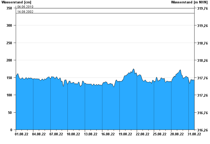
Chart of month Plattling / Isar
Waterlevel from 01.08.2022 to 31.08.2022
- 04.06.2013 Wasserstand: 400 cm
- 24.05.1999 Wasserstand: 378 cm
- 25.08.2005 Wasserstand: 374 cm
- 04.06.2010 Wasserstand: 349 cm
- 14.08.2002 Wasserstand: 335 cm
| Date | Waterlevel [cm] |
|---|---|
| 01.09.2022 00:45 | 143 |
| 01.09.2022 00:30 | 143 |
| 01.09.2022 00:15 | 143 |
| 01.09.2022 00:00 | 142 |
| 31.08.2022 23:45 | 142 |
| 31.08.2022 23:30 | 142 |
| 31.08.2022 23:15 | 142 |
© Bayerisches Landesamt für Umwelt 2024