
- Start >
- Rivers >
- Waterlevel >
- Naab - Regen >
- Pfrentsch >
- Chart of year

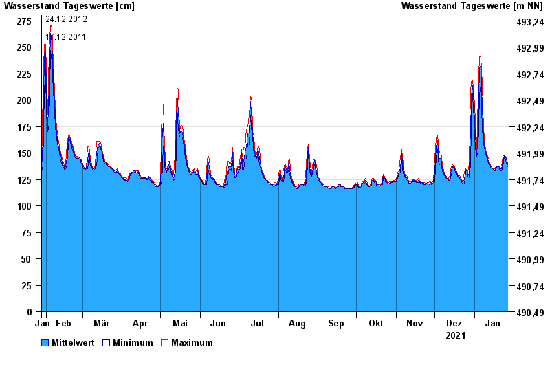
Chart of year Pfrentsch / Pfreimd
Waterlevel from 28.01.2021 to 27.01.2022
- 14.01.2011 Wasserstand: 311 cm
- 03.06.2013 Wasserstand: 310 cm
- 20.01.2012 Wasserstand: 283 cm
- 24.12.2012 Wasserstand: 273 cm
- 17.12.2011 Wasserstand: 256 cm
| Date | Mean value [cm] | Maximum [cm] | Minimum [cm] |
|---|---|---|---|
| 27.01.2022 | 139 | 141 | 137 |
| 26.01.2022 | 144 | 145 | 141 |
| 25.01.2022 | 147 | 148 | 145 |
| 24.01.2022 | 148 | 148 | 147 |
| 23.01.2022 | 142 | 147 | 138 |
| 22.01.2022 | 135 | 138 | 133 |
| 21.01.2022 | 135 | 137 | 133 |
© Bayerisches Landesamt für Umwelt 2024